
Site Data
South Lanarkshire Lanark
Latest Data: Updated 17/07/2025 11:00 GMT
| Pollutant | Index | Band | Concentration | Period |
|---|---|---|---|---|
| PM2.5 | 1 | LOW | 7 µg/m3 (Ref.eq) | 24 Hour mean |
| PM10 | 1 | LOW | 12 µg/m3 (FIDAS) | 24 Hour mean |
| NO2 | No Data | hourly mean | ||
| PM1 | No Data | 6 µg/m3 (FIDAS) | 24 Hour mean | |
| NO | No Data | hourly mean | ||
Mouse-over the graph to access further tools to analysis the data.
| Parameter | Parameter Name |
|---|---|
| PM10 | PM10 particulate matter (Hourly measured) |
| PM2.5 | PM2.5 particulate matter (Hourly measured) |
| PM1 | PM1 particulate matter (Hourly measured) |
Statistics for South Lanarkshire Lanark
| Site Name | South Lanarkshire Lanark |
|---|---|
| Site Type | Kerbside |
| Easting, Northing | 288427.04, 643700.54 |
| Latitude, Longitude | 55.673936, -3.775658 |
| OS Grid Ref | |
| Address | |
| Site Comments | The site is located on Lanark High St (A743) at the junction with Bannatyne St (B7107) and St Leonard St (A743). The nearest road is 0.5m from the site |
| Monitoring Network: Scottish Automatic Urban Network | ||
|---|---|---|
| Parameter | Date Started | Date Ended |
| PM2.5 particulate matter (Hourly measured) | 10/04/2015 | |
| Modelled Wind Direction | 01/01/2012 | |
| Nitric oxide | 01/01/2012 | |
| Nitrogen oxides as nitrogen dioxide | 01/01/2012 | |
| PM1 particulate matter (Hourly measured) | 10/04/2015 | |
| Nitrogen dioxide | 01/01/2012 | |
| Modelled Temperature | 01/01/2012 | |
| PM10 particulate matter (Hourly measured) | 10/04/2015 | |
| Modelled Wind Speed | 01/01/2012 | |
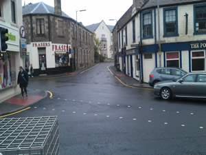
The photographs show the site itself, and views looking North, East, South and West.
-
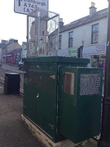
Monitoring Site Photo
-
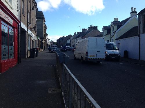
View North
-

View East
-
View South
-

View West