
Site Data
West Dunbartonshire Glasgow Road
Latest Data: Updated 18/07/2026 23:00 GMT
| Pollutant | Index | Band | Concentration | Period |
|---|---|---|---|---|
| NO2 | 1 | LOW | 12 µg/m3 | hourly mean |
| NO | No Data | 2 µg/m3 | hourly mean | |
Mouse-over the graph to access further tools to analysis the data.
| Parameter | Parameter Name |
|---|---|
| NO | Nitric oxide |
| NO2 | Nitrogen dioxide |
Statistics for West Dunbartonshire Glasgow Road
| Site Name | West Dunbartonshire Glasgow Road |
|---|---|
| Site Type | Roadside |
| Easting, Northing | 240234.67, 675198.79 |
| Latitude, Longitude | 55.943197, -4.559730 |
| OS Grid Ref | |
| Address | |
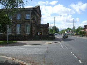
| Site Comments | Sited alongside busy thoroughfare, close proximity to Knoxland Primary School and bus lay by. This site was affiliated to the AURN as of 1st September 2010. The nearest road is 4m from the site |
| Monitoring Network: Scottish Automatic Urban Network | ||
|---|---|---|
| Parameter | Date Started | Date Ended |
| Nitrogen oxides as nitrogen dioxide | 26/04/2007 | |
| Modelled Temperature | 01/08/2010 | |
| Nitric oxide | 26/04/2007 | |
| Modelled Wind Speed | 01/08/2010 | |
| Nitrogen dioxide | 26/04/2007 | |
| Modelled Wind Direction | 01/08/2010 | |
The photographs show the site itself, and views looking North, East, South and West.
-
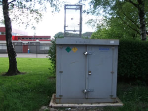
Monitoring Site Photo
-
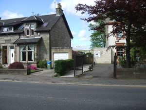
View North
-
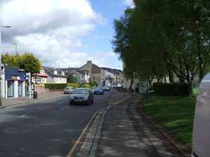
View East
-
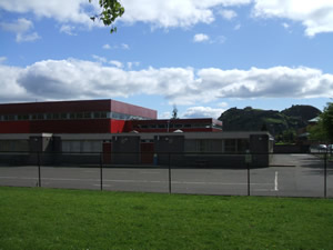
View South
-
View West